More and more often alarming signals ring out — rivers and wells are shallowing fast, streams are drying up, springs are silting over, blue mirrors are becoming overgrown with reeds. Why is this happening, and who is to blame? Once our rivers had crystal-clear water, but today they present a depressing sight.
Myrnohrad. Donetsk region. A pond on the Sinna River in the Sinna gully
Since time immemorial people have settled beside rivers, which were a source of water and food. Rivers large and small — providers not only for people but also for animals, birds and plants. Using the energy of water flows, people built water mills and power stations on them. Along these water highways they carried cargo, developed trade and floated timber. Rivers are often boundaries between settlements, administrative districts and states.
Mighty rivers are fed by tributaries, into which a multitude of small rivers and nameless streams flow. Countless blue ribbons form a full-flowing river basin.
The lowland small river Sinna, about 6 kilometres long, is a left tributary of the Kazennyi Torets (the Siverskyi Donets basin). Not all the residents of Myrnohrad know of the little river, its location and its name; in the southern part of the town the life-giving springs of the watercourse have not yet run dry.
Its source breaks through in the upper reaches of the Sinna gully, in the area of the waste heap of Mine No. 5-6.
Striving to the north-east, the stream flows into the Kazennyi Torets near the village of Mykolaivka in the Pokrovsk district, in the area of the Halyna Hirka reserve.
The mouth of the Sinna River near the Halyna Hirka reserve
After a dry summer, the river's mouth can be crossed without wetting your shoes.
The mouth of the Sinna River near the Halyna Hirka reserve
The local historian Serhii Lukovenko asserts that the name Sinna appears in documents and on all the maps of the Katerynoslav governorate from the end of the 18th century, as well as on the maps of the General Staff of the Red Army of 1938-1939. The toponym was given by the floodplain meadows, rich in grasses. On the banks of the river the people laid in stores of hay for their animals. And even now, in spring, the narrow strip of shore that has survived ploughing, building and quarrying is covered with a tender carpet of blooming primroses.
The slopes of the Sinna gully, at the bottom of which the Sinna River flows
Old-timers recall that in the 1940s a water mill operated on the Sinna at the spot where the gully is crossed by Tolbukhin Lane. Now this street is called Sinna (the former Zhdanov Street). In the 1930s, on the territory of the village of Novoekonomichne as a result of a dam that was built, the Siniansk reservoir appeared.
The dam of the Siniansk reservoir on the Sinna River
The spillway of the Siniansk reservoir on the Sinna River
There are two versions of its purpose — a reserve water supply for the enterprises and settlements of the Hrodivka and Novoekonomichne mines in the event of an accident at the Karlivka reservoir, and a water supply for the steam locomotives of Hryshyne station (Chervonoarmiiske). The stones and soil for the dam were brought on oxen. The reservoir never had to be used for economic purposes.
The Siniansk reservoir on the Sinna River
For several decades the Siniansk reservoir served as a favourite recreation spot for the residents of the surrounding towns and villages. On the shore a green massif was planted, a beach was created, and an open sanatorium for the workers of the "Krasnoarmiiskvuhillia" association was opened.
The water in the reservoir was clean and pleasant, with a bluish tinge, and so the name "Synianka" became attached to the water body and to the miners' health resort. With the commissioning of the "Komsomolska" processing plant, the enterprise's waste water was discharged into the reservoir. Since 2014 the sanatorium has been closed.
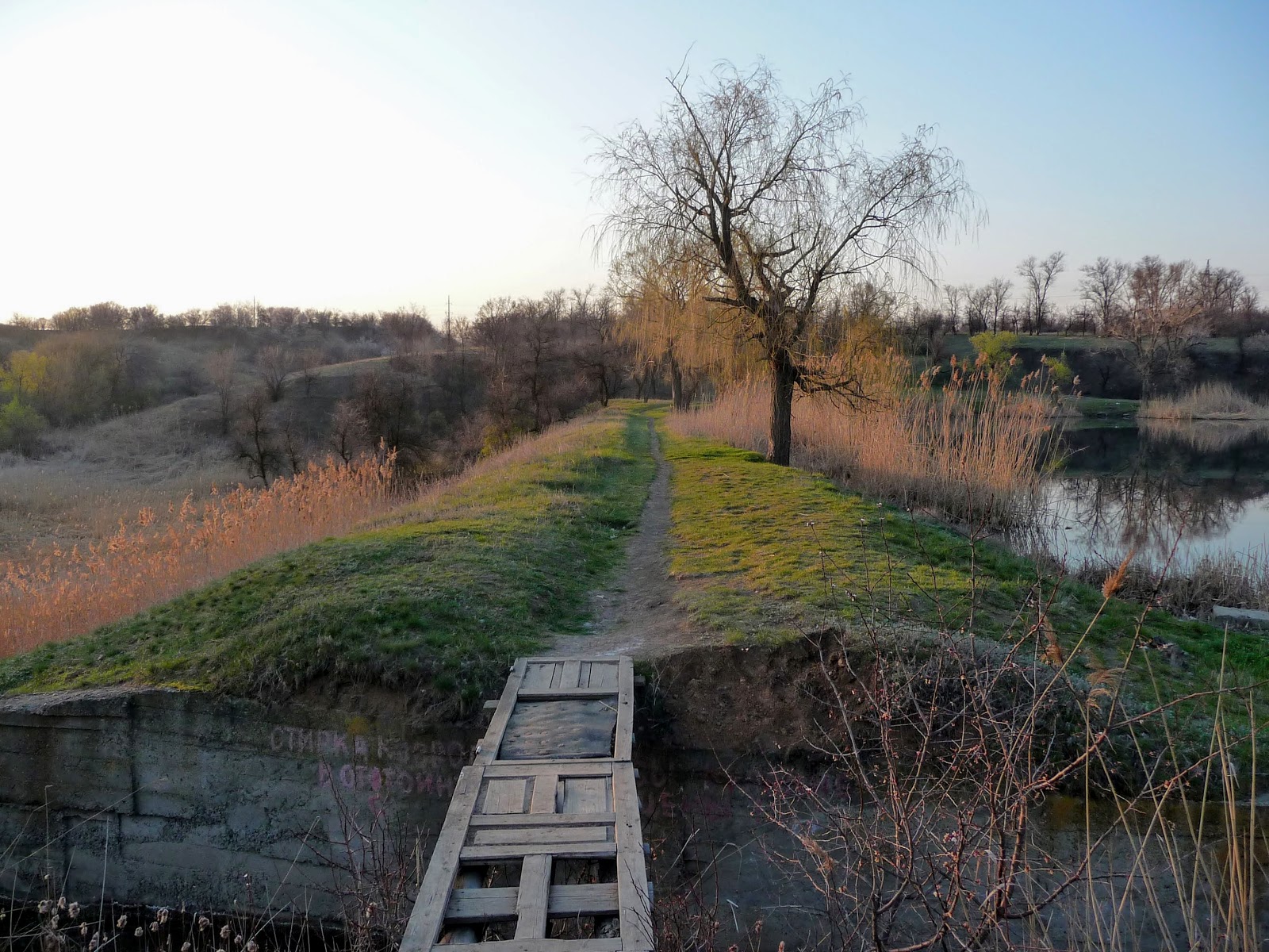
In the early 1960s, in the Sinna gully near Mine No. 5-6, a dam of an earthen bank and concrete slabs was raised and a pond was created.
A pond on the Sinna River. The dam
A pond on the Sinna River
Despite the settling basin being replenished by the mine's groundwater, the pond was put in order and stocked with fish; on the shore a diving tower and a jetty were built, and a boat station, a rescue station, a snack bar and a radio room were opened.
On summer weekends there were as many holidaymakers on the beach as on the seaside, with no room to swing a cat. Amateur groups put on Fisherman's Day and the festival of Neptune.
The Donetsk region is not rich in surplus water resources, and its summer is marked by an apogee of high temperatures and a lack of rain. In the heat, the locals of this densely populated region save themselves from the stifling air and overheating at the ponds — as the artificial water bodies are called.
The Sinna River. A small water body
Unfortunately, industrialisation does not entail a careful attitude to natural water wealth.
The Sinna River. Spillways
Sludge waters from Mine No. 5-6 are discharged into the Sinna gully.
The cascade of settling basins, located near the river's source, has destroyed the water flow created by nature.
The black liquid that drains into the pond contains coal particles and spent fuel oil.
Enormous masses of waste heaps are creeping ever closer to the Sinna.
Waste heaps on the left bank of the Sinna River
As a result of chemical reactions, harmful substances are released from the slag heaps, accumulate in the surface layer and inevitably end up in rivers, ponds and wells.
The left slope of the gully and the riverbank have been mangled by the extraction of sand and clay in deep quarries.
Sand and clay quarries on the left bank of the Sinna River
The relief surface of the picturesque gully is used by motorbike-racing enthusiasts, who have created ramps and tracks.
Motocross tracks on the slopes of the Sinna gully
Great harm is done by mad pyromaniacs who stage fire shows in the river valley.
A burnt-out patch in the valley of the Sinna River
Burnt reeds recover very quickly, but the grass cover of the meadow grasses disappears forever. What remains is weeds and wild young growth, which grows back very fast.
In the fire, birds, hedgehogs, hares, grass snakes and other small animals perish, and nests and burrows are destroyed. The traces of the burning remain a black avalanche in the river valley.
Burnt reeds and grass cover on the slopes of the Sinna gully
Depressing is the sight of the huge number of spontaneous dumps, the mountains of plastic packaging in the coastal strip. The residents of the nearest neighbourhoods and villages do not consider the accumulation of construction rubbish beside the river a shameful thing.
A culvert pipe and the remains of a hydraulic structure by the Sinna River
Water flows are increasingly poisoned by human activity. Mismanagement and indifference lead to disruptions in the ecosystem and changes in the microclimate. As a result of a long period of dry and hot weather, a hydrological drought sets in. A persistent shortage of precipitation tells on the level of the water bodies; riverbeds become overgrown, rivers dry up, and areas of stagnant water form. Industrialisation and the burning of fuel create a greenhouse layer in the atmosphere. The most noticeable manifestation of this dangerous process — drought and the shallowing of rivers.






No comments:
Post a Comment
Leave your impression