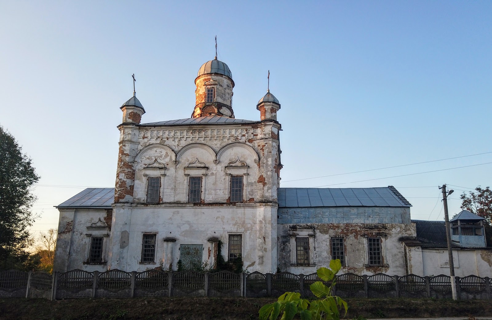
Myropillia — a village in the north-east of Ukraine, in the east of Sumy region, 40 kilometres from the regional centre. This small settlement in the Sumy area has more than a dozen architectural monuments, but there are far more unique buildings that deserve attention and protection. St. Nicholas Church of St. Nicholas Monastery has an unusual design, the tallest bell tower in the eparchy and a rich history.
 |
| Myropillia. Sumy region. Krasnopilskyi district. St. Nicholas Church. 1885. |
To see the shrine, I walked the road from the neighbouring village of Zapsillia, taking in its monuments, houses and communal amenities along the way.
 |
| Zapsillia. Sumy region. Krasnopilskyi district. |
The Holy Trinity Church was built in the centre of the village, right by the main road.
 |
| Zapsillia. Holy Trinity Church |
This cross-shaped building with four domes has long been closed. The peeling plaster and the paint on the doors, the old steps of the semicircular porch — everything says that services are no longer held in the church.
 |
| The abandoned Holy Trinity Church |
In the churchyard, a small chapel was raised for the villagers' needs; the services held there are announced by two bells and four cut-off gas cylinders, hung on a wooden crossbar and two plain little posts.
 |
| The new Holy Trinity Church |
Next to this place of prayer stands a kindergarten, housed in a brick building that may once have been a zemstvo school.
 |
| The kindergarten |
Across the road is a war memorial with the common grave of eight Red Army soldiers who died liberating Zapsillia in 1943. In memory of the local men who passed through the crucible of war, marble slabs have been set up with the carved names of the front-line soldiers.
At the crossroads there is a signpost, "Heartfelt Well". The sincere name of the spring cannot help but draw a traveller in, and I set off in the direction indicated, towards the north-western edge of the village, although I actually needed to head east.
Morning in the countryside is marked by the cattle and poultry being let out to pasture. The villagers set out churns of milk beside the milk truck as it passes along the asphalt street and hand over their yield at 4 hryvnias a litre. They unhurriedly share the news and glance at me with curiosity. "And what will this be?" a local resident asks, looking at my camera. "A photo tour," I reply.
The buildings are mostly wooden; the little houses and fences are painted in all sorts of colours — bright and modest alike — so the walk turned out a cheerful one.
The distance to the well proved a third longer than the sign stated — over 620 metres. An ordinary well with reinforced-concrete rings, no cover over the shaft, a bucket hung on a thin cable. It is fenced off and covered on top with slate. There was no bench, no cross, nor any sign of its "heartfelt" nature. Probably, while drawing water, the villagers hold heartfelt conversations with one another. Later, from readers' comments, I learned that the "Heartfelt Well" stands on the neighbouring street by the river — and this one is just an ordinary well.
The village owes its name to its position on the right bank of the Psel.
The bridge over the river carries you straight from Zapsillia into Myropillia.
 |
| The bridge over the Psel |
At this spot the Udava flows into the Psel, winding between Ukraine and Russia, and in places the Russian-Ukrainian border runs along its channel.
 |
| The confluence of the Udava and the Psel |
 |
| Beyond the river lies the village |
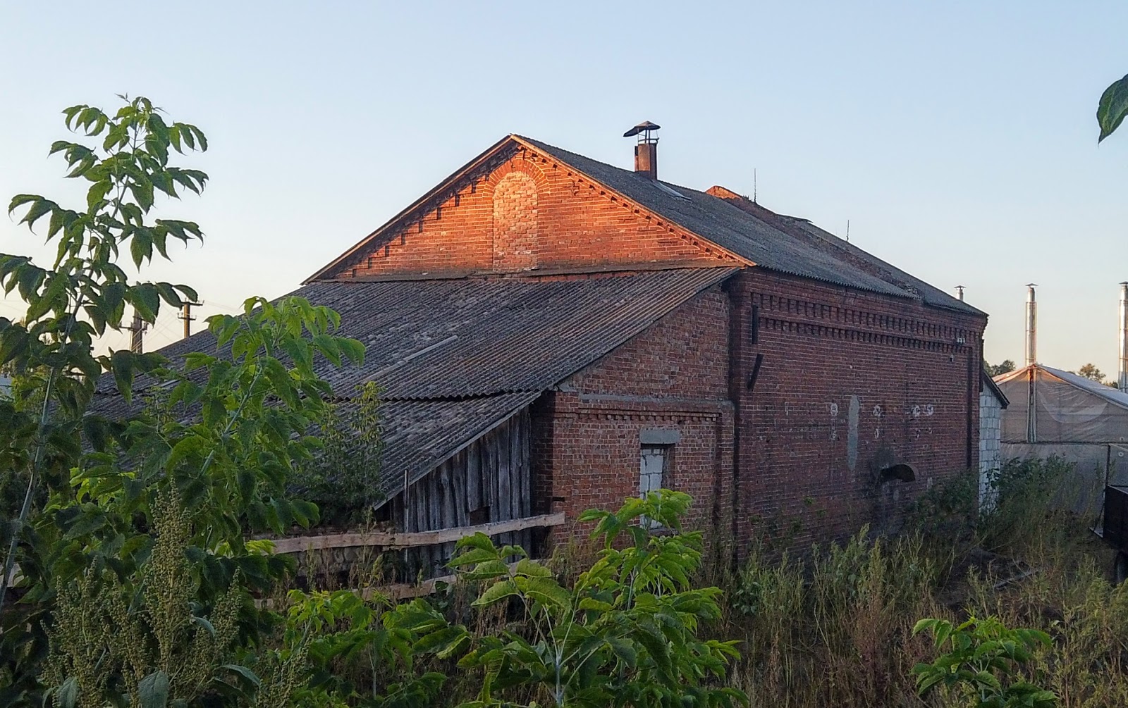
The first buildings in Myropillia are the old mill and the premises of the footwear factory that produced goods for the army.
 |
| The old mill |
 |
| The former footwear factory |
The village owes its name to settlers from Myropillia in Volhynia, who arrived in these parts in the middle of the 17th century. The industrious people of Myropillia developed grain farming, weaving, and the blacksmith's, leather and shoemaker's trades. The water meadows and fertile lands favoured cattle-raising, and the abundance of livestock spurred the appearance of master bootmakers.
In the second half of the 17th century the settlement received town status and held it until the beginning of the Second World War, moving in and out of the various governorates that surrounded it on all sides. After the war Myropillia is listed as a rural administrative unit of Sumy region.
 |
| Laying in firewood. Heating in the village — by stove. |
 |
| Geese — the best guards |
The population, which in past times numbered from 6,000 to 10,000 to 23,000, has shrunk several times over and now stands at about 2,200 residents.
Once there were brick, tile, saltpetre, cheese-making and other works in Myropillia. The border town was famous for its fairs, held 3-5 times a year. The central street is Sumska; before the revolution it was Kurska, and in Soviet times, until 2016, it bore the name of the leader of the proletariat.
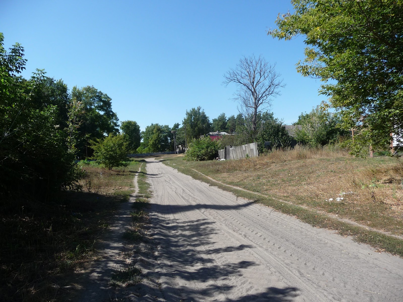
From the market square the streets fan out, and not all of them were destined to be paved.
The houses are built as if along a ruler and open straight onto the road.
Stone fences with gates of various shapes surround the mansions.
 |
| Sumska Street. A 19th-century estate. |
 |
| Sumska Street. A 19th-century estate. |
 |
| The gate by the former 19th-century shop. |
 |
| Sumska Street. A modern gate. |
At one wooden gate the palisade has not survived, but a specimen of wooden craftsmanship has been preserved as the artistic decoration of a young public garden.
Some sturdy merchant dwellings have met the fate of unfortunate renovations.
 |
| Sumska Street. A 19th-century estate. |
Some of the private buildings are occupied by institutions, a pharmacy, the post office and shops.
 |
| Sumska Street. The House of Culture. A former girls' gymnasium of the 19th century. |
 |
| A shop |
 |
| A shop |
 |
| Sumska Street. The post office. A former parish school. |
 |
| Kharkivska Street. The pharmacy. A former gentleman's house. |
The facades are skilfully decorated with original brickwork ornament, the windows framed with a distinctive pattern.
 |
| Sumska Street. 19th-century estates. |
Identifying the buildings is not easy; there are no plaques with numbers on the houses.
 |
| Sumska Street. 19th-century estates. |
 |
| Doroshenka Street. An abandoned 19th-century estate. |
Commemorative plaques with the date of construction and protected status have never been seen here by anyone.
 |
| Sumska Street. The house in which a war invalid lived. |
The residents can tell almost nothing about their beautiful houses or recall their history.
 |
| Sumska Street. Residential houses. |
Even the education worker I met after a meeting of the sowers of the reasonable, the good, the eternal on the eve of the school year advised me to look for information on Wikipedia. The single-storey building, once called a coaching inn, belongs to the primary school.
 |
| Sumska Street. The primary school. A former parish school. 19th century. A former old people's home. |
In tsarist times Myropillia was among the three largest towns in the district, and great attention was paid to education in the town. A private girls' gymnasium existed in 1908-1918. Among the pupils were not only the daughters of well-off parents but also children from poor peasant families. After seven years of study, the gymnasium girls taught in schools and worked in other state institutions.
 |
| Sumska Street. A former 19th-century shop. |
The village administration building occupies a two-storey mansion, a former boarding school. By the entrance to the village council, statues of workers from the socialist-realism era are still kept.
 |
| Sumska Street. The village council. A former mansion. A former boarding school. |
Another park sculpture no longer looks quite so optimistic.
A little over 30 toddlers are raised in the kindergarten, but the education worker knows nothing of the manor house's historic past.
 |
| The kindergarten. A former estate. |
Another school, and later a kindergarten, could not be saved, and the beautiful building has turned into a ruin.
 |
| A former boys' gymnasium, later — a school and a kindergarten |
No use has been found for the priest's house, which stands beside the remains of the bell tower of the Church of the Transfiguration of the Saviour, built in 1883.
 |
| The former priest's house |
Despite their status as architectural monuments, the historic structures of the 19th century are crumbling before our eyes.
 |
| The bell tower of the ruined Church of the Transfiguration of the Saviour. 1883. An architectural monument. |
The building of the zemstvo hospital has not lost its purpose; it is occupied by the village outpatient clinic.
 |
| The outpatient clinic. The former Hlukhovtsev mansion. 19th century. |
Another block, which housed the laboratory, was less fortunate.
 |
| The abandoned medical laboratory |
The radio-communications building gapes with its broken windows.
 |
| Sumska Street. The abandoned radio-hub building. |
The original brick ornament shows through the whitewash washed away by time. People of Myropillia live in the house, and the premises of the former power station serve them as a shed.
 |
| Sumska Street. A residential house. |
 |
| Sumska Street. A shed. The former power station. |
 |
| The inscription on the facade of the former power station |
Time has not spared a newer structure either, one built outside the architectural traditions of Myropillia. A shop has taken up residence in the former house of consumer services.
 |
| Sumska Street. The former house of consumer services. |
Before the godless years, Myropillia had eight churches. One of them survived the wars and hard times — St. Nicholas Church, built in 1885.
 |
| Sumska Street. St. Nicholas Church and the bell tower of St. Nicholas Monastery. |
After neglect and ruin, the shrine is being restored through the efforts of the community. The church and the climb up the tallest bell tower in Sumy region will feature in the next post.
 |
| The Church of the Icon of the Mother of God "Joy of All Who Sorrow" of St. Nicholas Monastery |
As the villagers themselves say, they have everything — forests, and rivers, and chalk hills, and steppes. Rich nature, fertile soil, skill and industriousness. Throughout the route I kept coming across storks' nests.
By autumn the homes of these feathered creatures, which symbolise new life, prosperity and happiness, had emptied. But in spring they will return once more to their nesting sites, to their familiar places.
You can get to Myropillia by bus from the central bus station in
Sumy. The first departure is at 4.45. Buses run back to the regional centre every hour to hour and a half.
Coordinates: 51°1’22"N 35°15’31"E








No comments:
Post a Comment
Leave your impression