The Krovetska Ravine. A Hike to a Geological Monument
Purpose of the hike: to visit the geological nature monument of state significance, the Krovetska ravine, with a look at the surface outcrop of rock. Route: the Ivanopillia stop (6th kilometre), a worked-out quarry, the village of Ivanopillia, the Krovetska ravine, the Pleshchiivka stop. Distance: 14.2 km over hilly terrain. Time: 5 hours 45 minutes.
To see the rare geological formations in the Krovetska ravine, you can take the Sloviansk-Fenolna or Izium-Fenolna suburban train from Kramatorsk, Kostiantynivka, Sloviansk, Druzhkivka to the Ivanopillia stop (6th kilometre).
The reserve is located in the south-eastern part of the village of Ivanopillia, Kostiantynivka district, but first I crossed the railway track in the opposite direction — I did not want to miss the chance to look over the worked-out quarry. A winding path leads out to the cliffs of the abandoned cut.
Almost Martian landscapes. The clay was used for making roof tiles and bricks.
At the bottom of the clay pit a pond has formed, to which, judging by the hoofprints, cows come to drink.
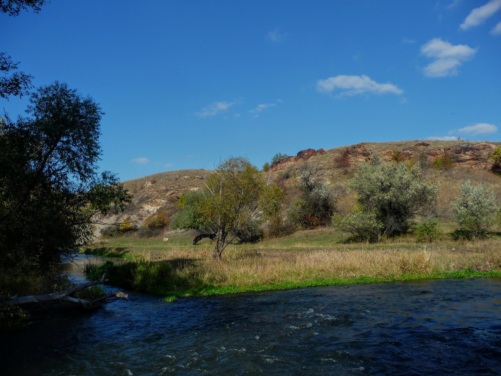
The level steppe gives way to hills and shallow gullies. Ravine woodland covers the undulating relief in places.
The metal bridge over the Kryvyi Torets responds to the steps of a lone traveller in the absolute silence with a hum and a strong swaying.
The name Torets comes from the name of the fortified post Tor, which stood on the territory of present-day Sloviansk. For the curve of its channel, this blue artery of the steppe was named just so — the Kryvyi Torets, the Crooked Torets.
The settlements in the valley of the once-navigable river arose about 300 years ago. Ivanopillia was founded in the first half of the 18th century and now numbers about 1,500 residents. The centre of the village — a shop, a post office, an outpatient clinic, a monument to the fellow villagers who died.
The house of culture was built in 1970 of stone from the local quarry. This hub of the villagers' cultural life has not faded and is now undergoing major repairs.
The school in the village was built even before the revolution by the local landlord Pleshcheiev. In 1966 a new teaching block was opened.
Ivanopillia is supplied with gas and lives a quiet rural life, surrounded by industrial towns.
I walked 3 kilometres along Tsentralna and Sadova Streets to the southern edge of Ivanopillia, where the harvest had not yet been gathered in the vegetable gardens. Autumn delights with its fruits.
The railway crossing stayed to the right; I entered the green thicket and almost missed the path to the little bridge among the undergrowth.
Along the bank grazed unattended cows; at any rate, there was no herdsman beside them to whom I might have put a couple of questions about the ravine. The animals showed interest in me, examining the unfamiliar traveller.
On the height the first stone boulders appeared; I climbed up to them not along a path but over the dried grass.
Here and there, on the sun-open slopes with their scorched vegetation, bushes of hawthorn and dog rose reddened.
200-300 million years ago, on the territory of present-day Donetsk region, complex tectonic processes were taking place.
Large sections of the earth's crust thrust one over another, compressing the hard rocks into folds.
It is hard to imagine, but here, where there is now steppe, mountains up to 5 kilometres high were formed.
The bowels of the earth threw hot water and gas geysers to the surface, which transformed the sedimentary rocks and formed zones with various ores and minerals. The cliff-like outcrops of sandstone with fragments of ancient petrified araucaria trees are a rare natural phenomenon. It is as though nature has left a visual aid for studying the history of the formation of the earth's crust.
The ravine, to my mind, has the shape of a shirt, whose lower edge, along a steep slope for one kilometre, is bounded by the river Kryvyi Torets.
The outcrop of the araucarite series of the Upper Carboniferous deposits girdles the ravine in a fold from north-west to south-east. In the middle part two deep gullies, in the form of sleeves, stretch to the north and north-east for about 600 and 500 metres. To approach the next group of monoliths, the gullies must be skirted along the virgin section of the ravine, which has an area of 15 hectares.
To make one's way through the thickets along the bottom of the gully is hard and dangerous.
The Krovetska ravine. Mushrooms
The hollow between the folds of the ravine has been filled by water flowing down the gullies. By the bank of the pool there is even a wooden footbridge for fishing.
The path along the steep bank led out onto a hill, from which a panorama opens onto the surrounding villages and the mines of Toretsk.
The stone boulders differ in colour and size.
Among the small heaps of stone protrude enormous rocks with layers of gravelite and minerals that have oxidised under external influences.
During the intensive formation of the earth's solid crust, hurricanes and downpours felled huge araucaria trees, which vanished into the layers of washed-in sand.
The absence of oxygen at the bottom of the seas and lakes helped to preserve the fragments of prehistoric wood.
The largest specimens of petrified araucaria can be seen in the quarry near Oleksiievo-Druzhkivka.
The accumulations of grey-yellow sandstone have created picturesque scenes and fantastic landscapes on the slopes of the Krovetska ravine.
The largest boulder has a red tint, which testifies to the presence of iron oxides in the ore.
Water and wind, in co-authorship, have worked as sculptors over these unique creations for centuries; these natural architects have made, and continue to make, their contribution.
The second sleeve of the ravine again had to be skirted around to approach the next rocky ridge. In wet weather the stones can be slippery and the steep slopes dangerous to move on.
On its eastern border the little ravine is surrounded by arable land, and to the north the Kostiantynivka-Toretsk motorway approaches.
In 1975, by order of the Council of Ministers of the Ukrainian SSR, the Krovetska ravine was granted the status of a geological nature monument of national significance.
The old residents of Ivanopillia pass down from generation to generation a legend that once there lived in the ravine a stone carver, Kravets, whose surname served as the name of the toponym.
But the name of the river Kryvyi Torets, too, has a phonetic kinship with the name of the Krovetska ravine.
At the end of the excursion I descended to the southern edge of the ravine, where a marker stone has been set up.
From there I reached the deserted Nelipivka, with its ruined and shuttered houses, and turned towards Pleshchiivka, familiar from my hike into the regional Kleban-Byk landscape park, which since 2005 has also included the Krovetska ravine.
The wooden suspension footbridge, with its wide swing at every step, carried me to the other bank of the Kryvyi Torets.
There were still about 30 minutes left before the arrival of the Fenolna-Havrylivka suburban train, and I could not simply waste the time by failing to drop into the Pleshchiivka house of culture. Such a small rural hub of culture and leisure has not faded, thanks to its manager — who is at once the leader of the clubs, the librarian and simply a good person — a young woman named Nadia.
The upshot of the hike: everything went according to plan — interesting, instructive and striking. The Krovetska ravine is a unique nature monument and a wonderful site for hiking.




No comments:
Post a Comment
Leave your impression